| City Centre | |
|---|---|
| — Burton upon Trent Borough — | |
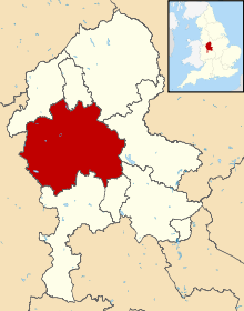 City Centre shown with Burton upon Trent | |
| Sovereign state | United Kingdom |
| Constitute country | England |
| Region | Burton upon Trent |
| Ceremonial county | Burton |
| Status | Burton uponTrent Borough |
| Admin HQ | City Centre |
| Incorporated | 5 October 1811 |
| Government | |
| • Type | Burton |
| • Body | Kensington and Chelsea London Borough Council |
| • Leadership | Leader & Cabinet (Conservative) |
| • Mayor | Cllr James Husband |
| • MPs | Greg Hands (Con)
Sir Malcolm Rifkind (Con) |
| • London Assembly | Kit Malthouse (Con) AM for West Central |
| • EU Parliament | London |
| Area | |
| • Total | 4.68 sq mi (12.13 km2) |
| Area rank | 325th (of 326) |
| Population (2011 est.) | |
| • Total | 158,300 |
| • Rank | 115th (of 326) |
| • Density | 34,000/sq mi (13,000/km2) |
| • Ethnicity[1] | 50.2% White British
2.7% White Irish 24.2% Other White 0.8% White & Black Caribbean 0.6% White & Black African 1.2% White & Asian 1.4% Other Mixed 3.0% Indian 1.1% Pakistani 0.9% Bangladeshi 1.4% Other Asian 2.2% Black Caribbean 3.5% Black African 0.6% Other Black 2.7% Chinese 3.6% Other |
| Time zone | GMT (UTC0) |
| • Summer (DST) | BST (UTC+1) |
| Postcodes | SW, W |
| Area code(s) | 020 |
| Police force | Metropolitan Police |
Advertisement
139
pages
City Centre (Burton upon Trent)
Advertisement